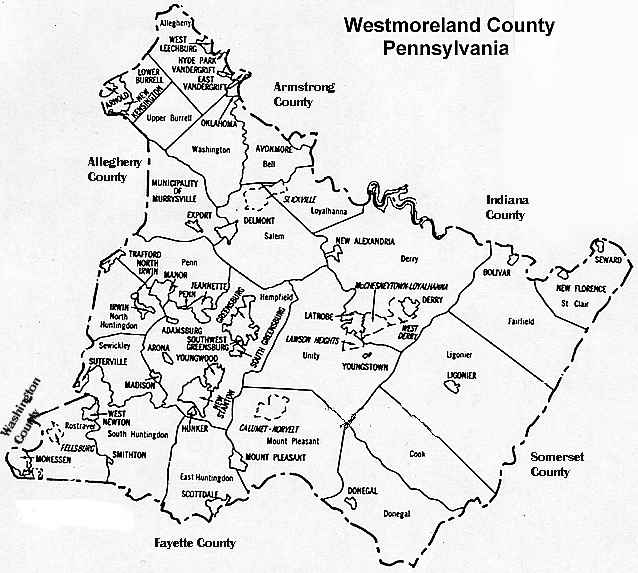
Westmoreland County Pennsylvania
Township Map
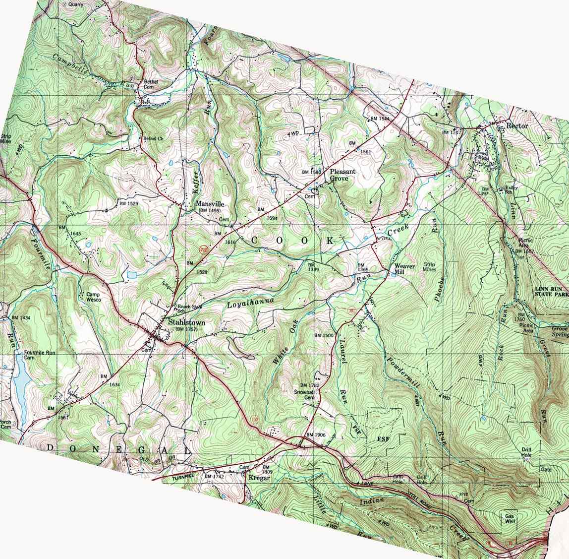
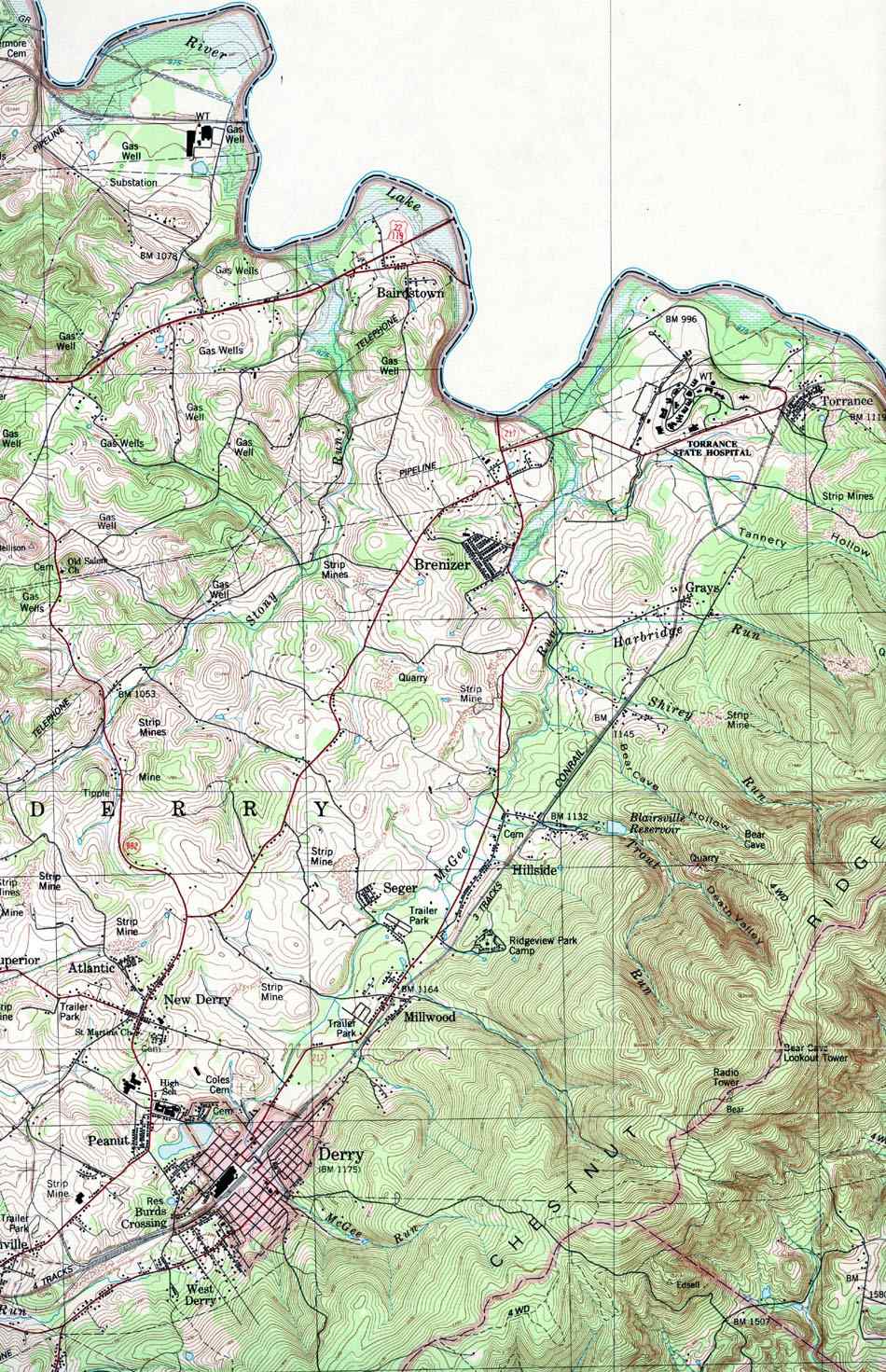
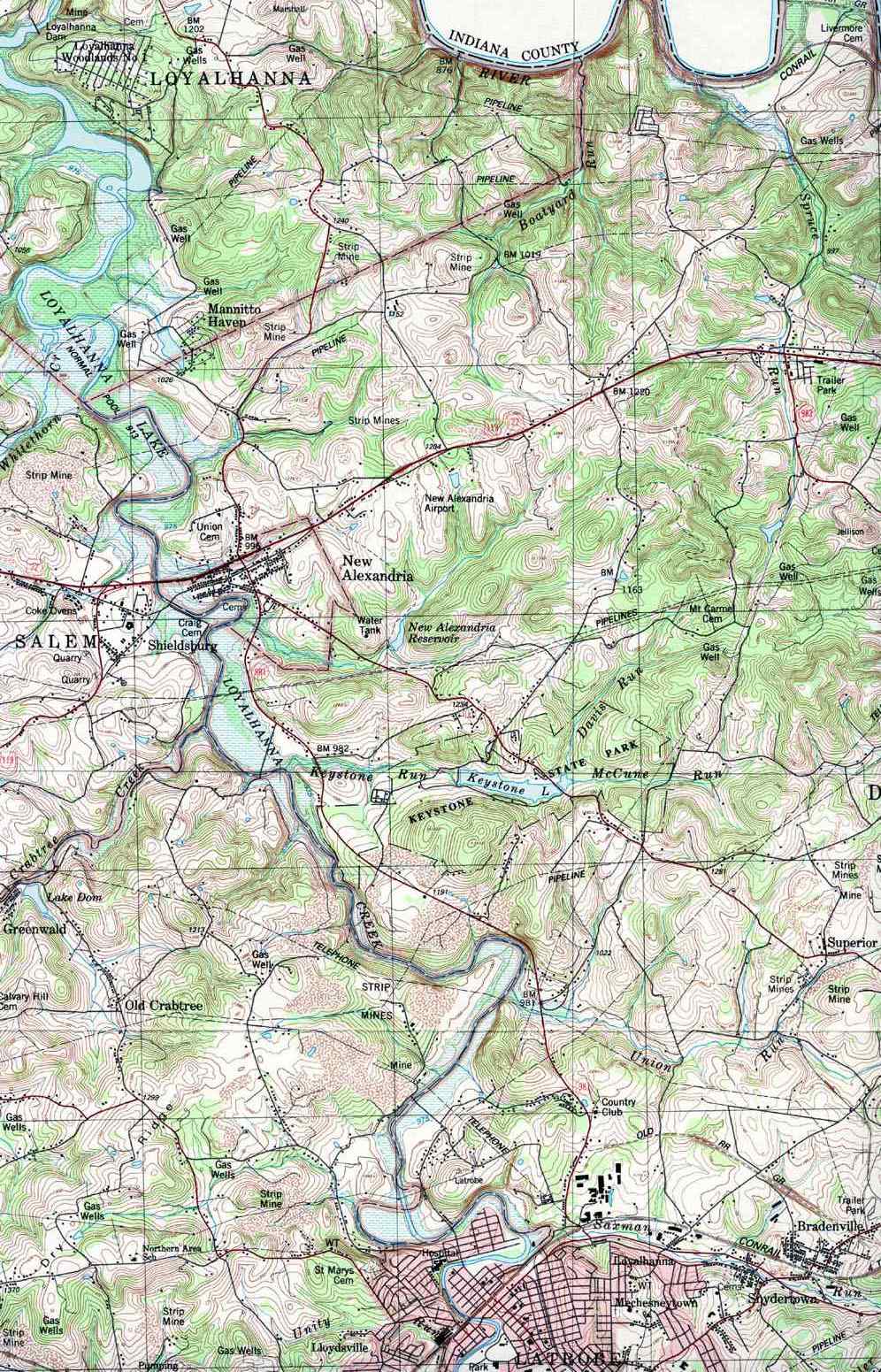
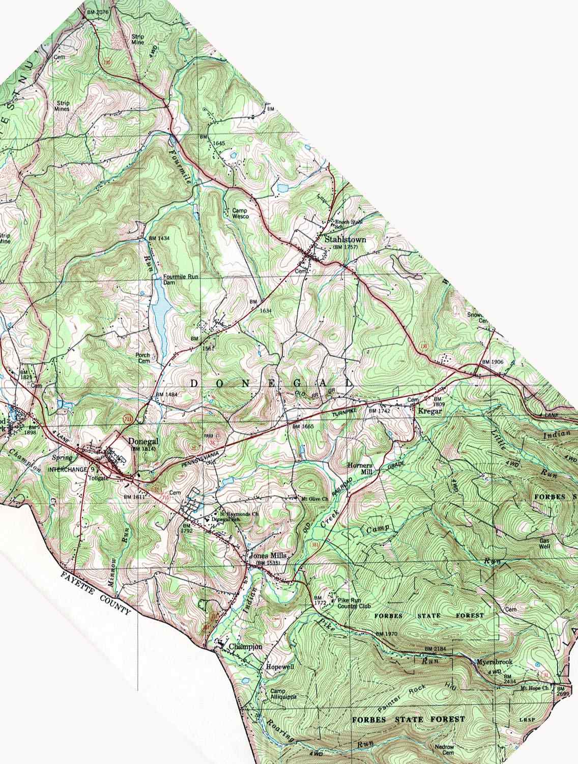
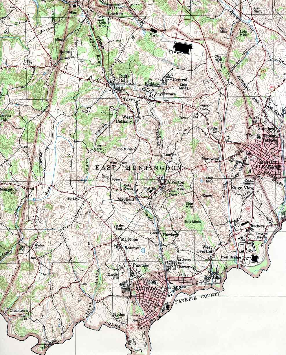
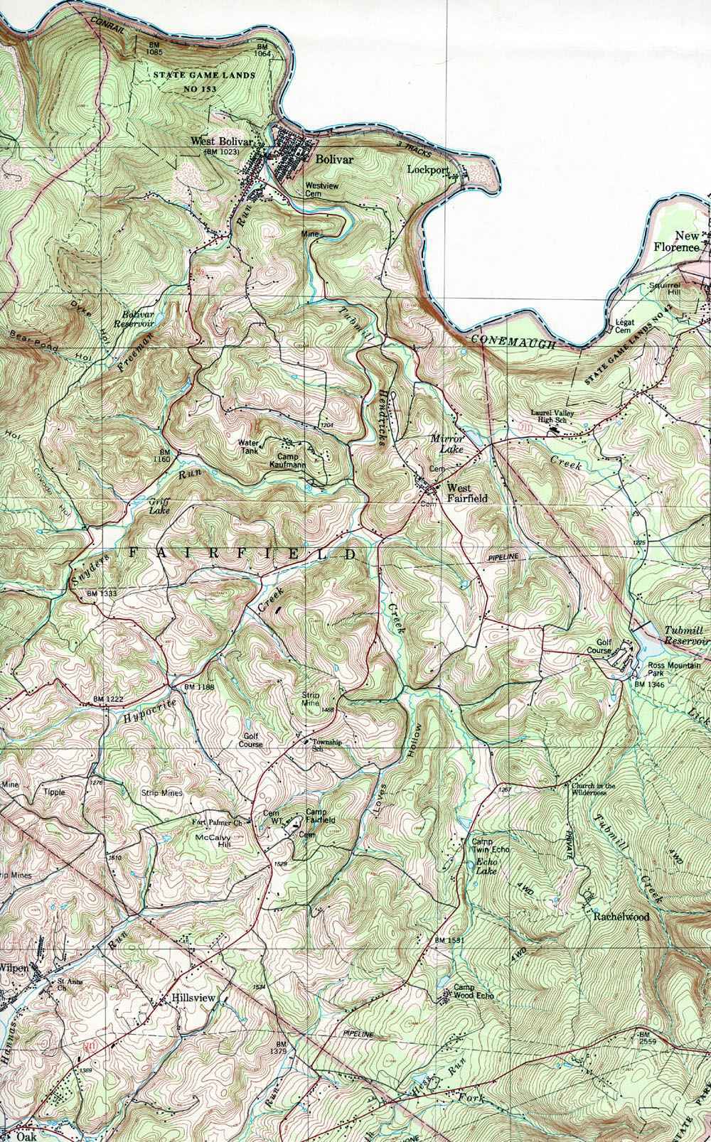
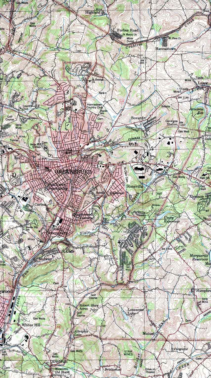
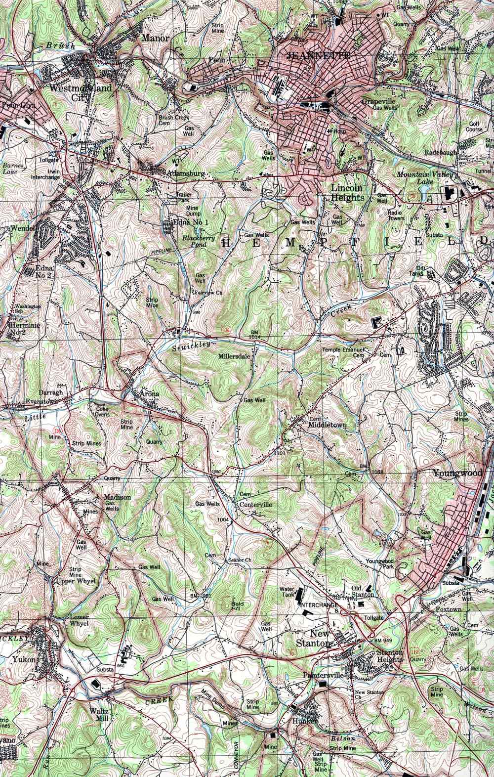
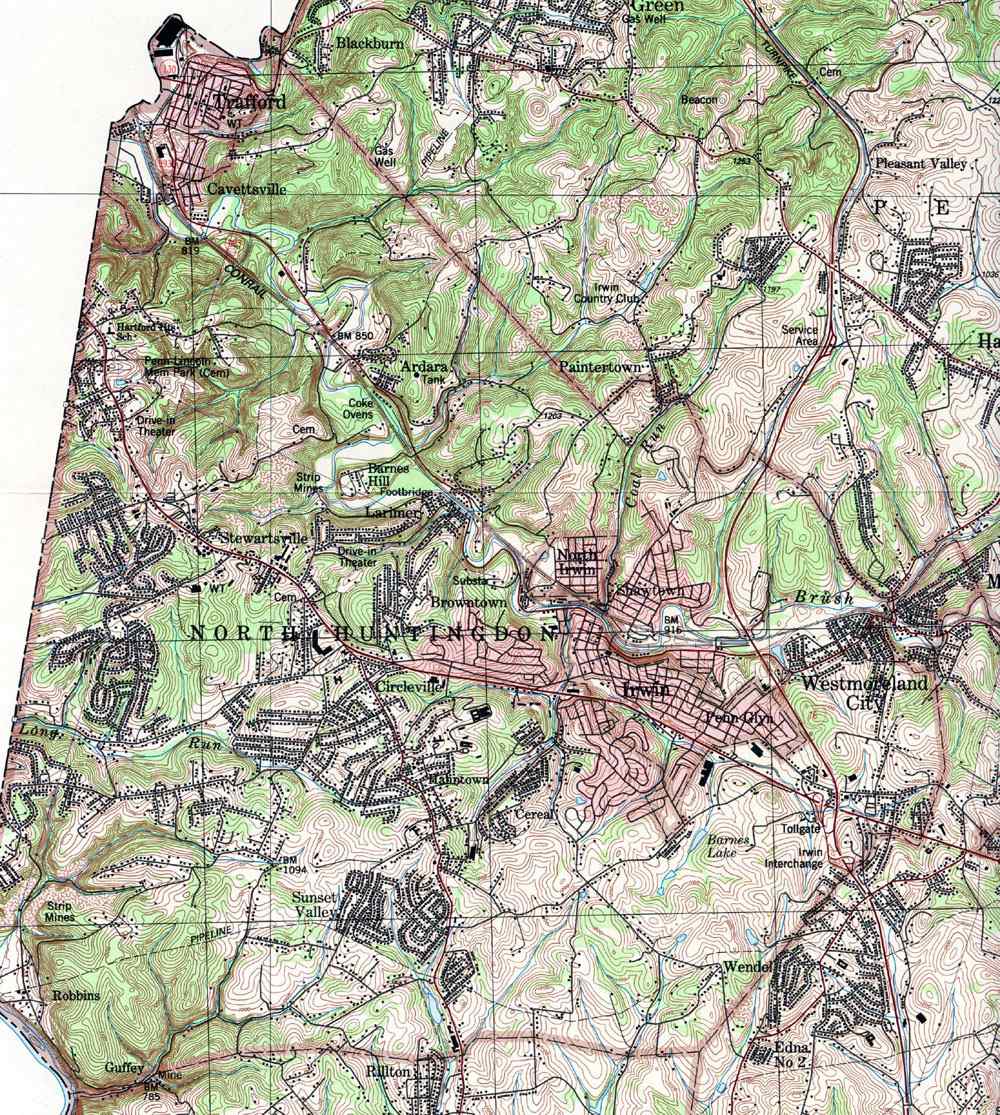
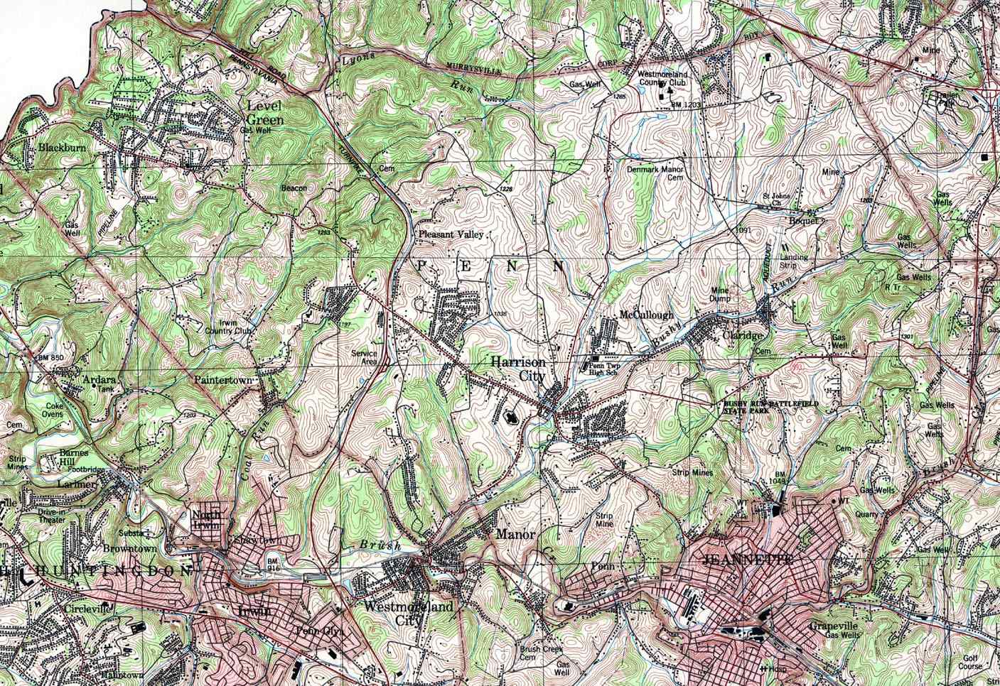
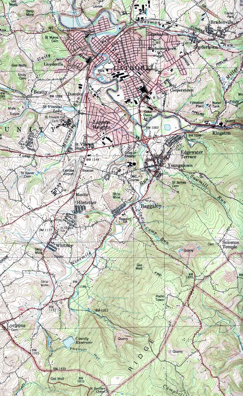
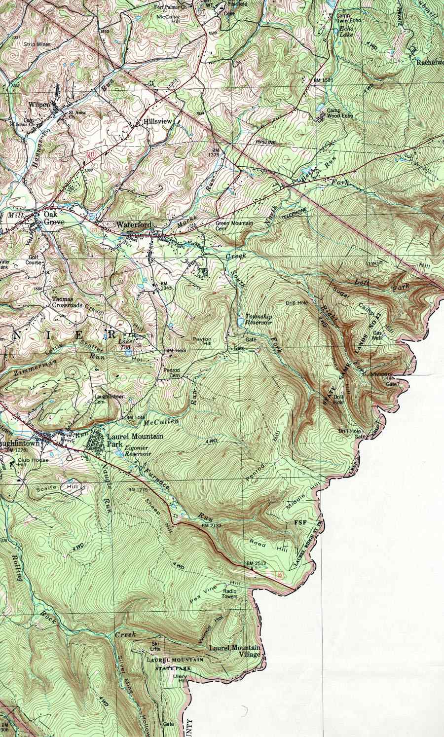
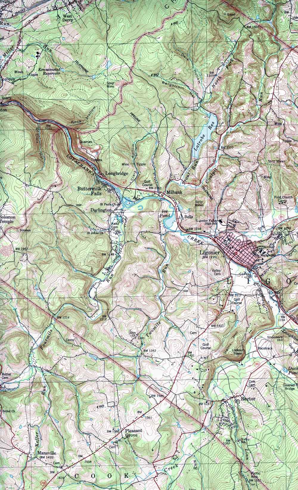
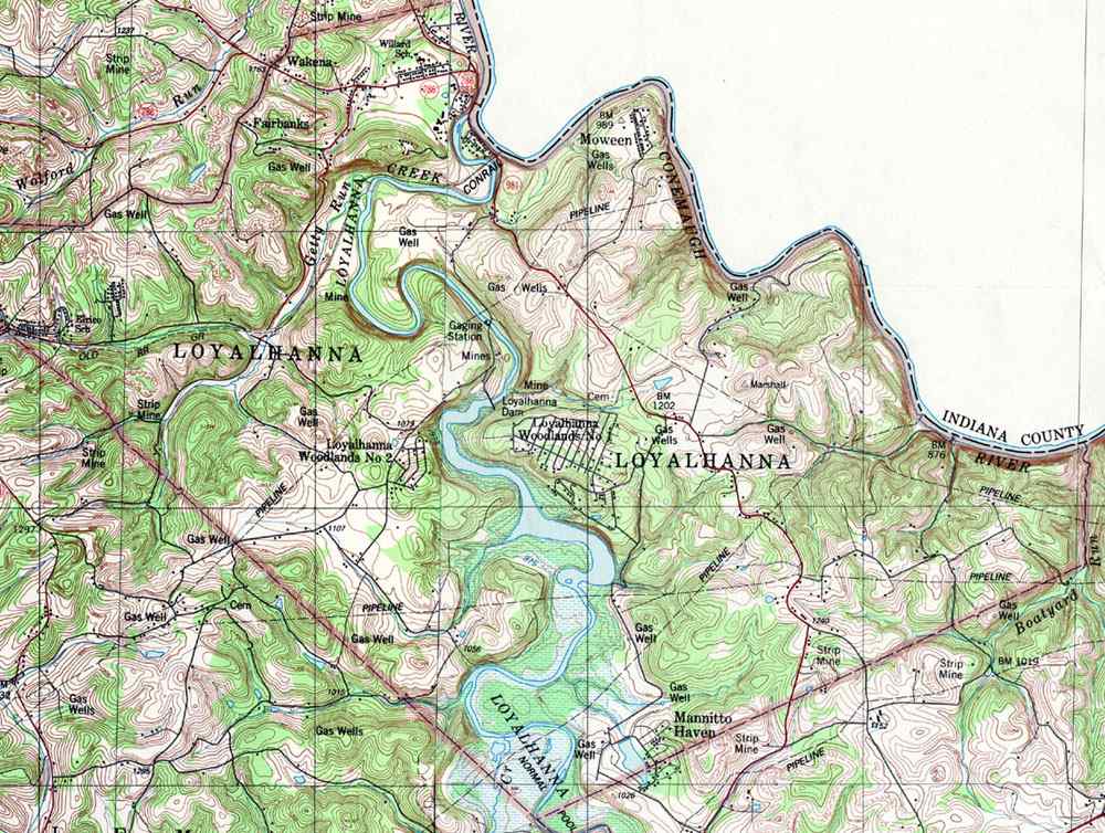
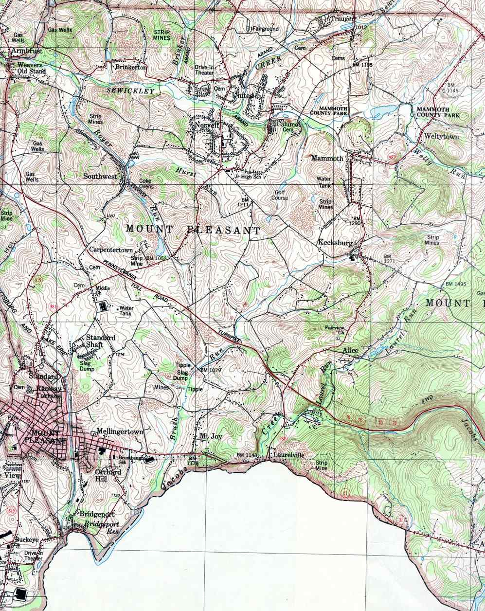
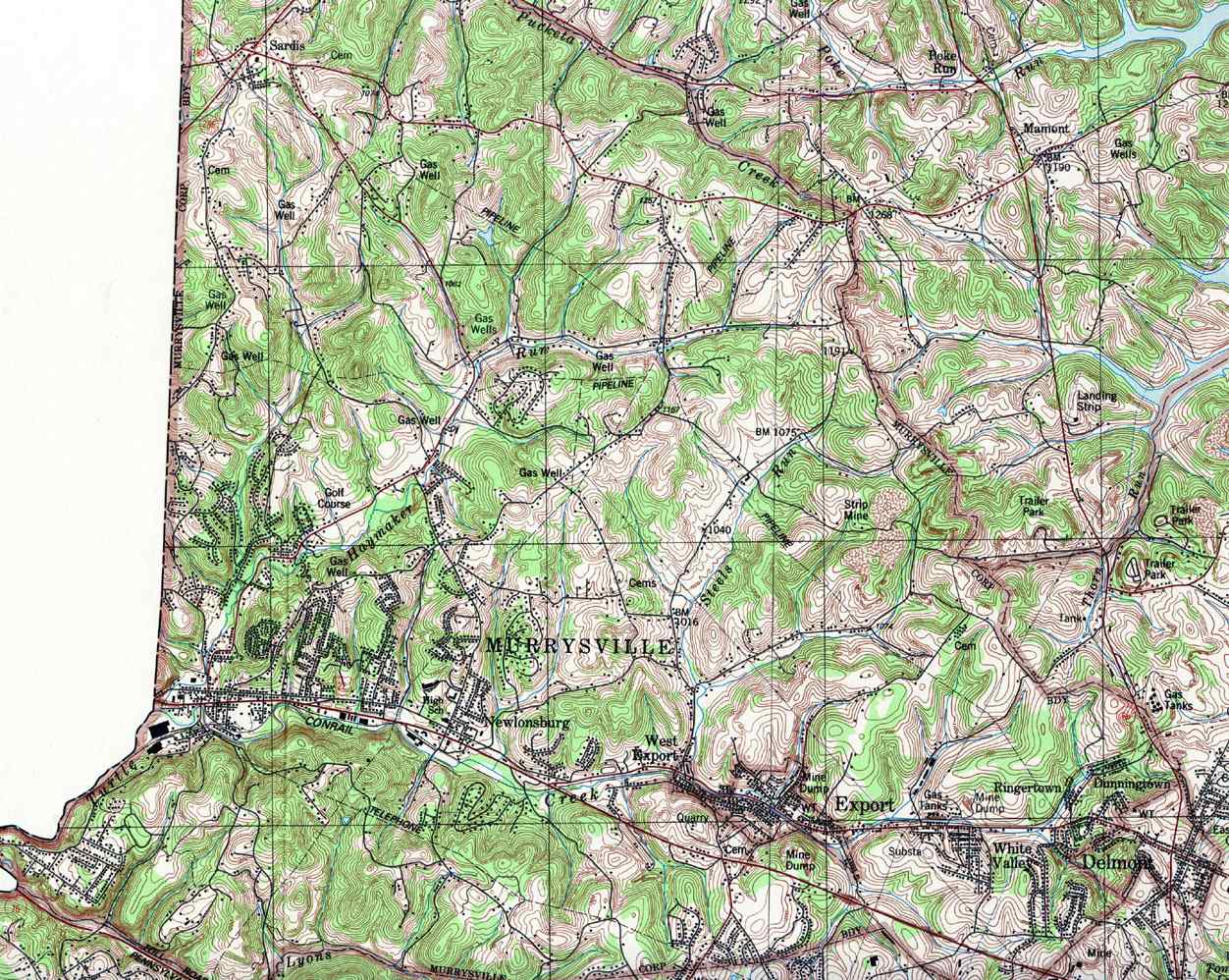
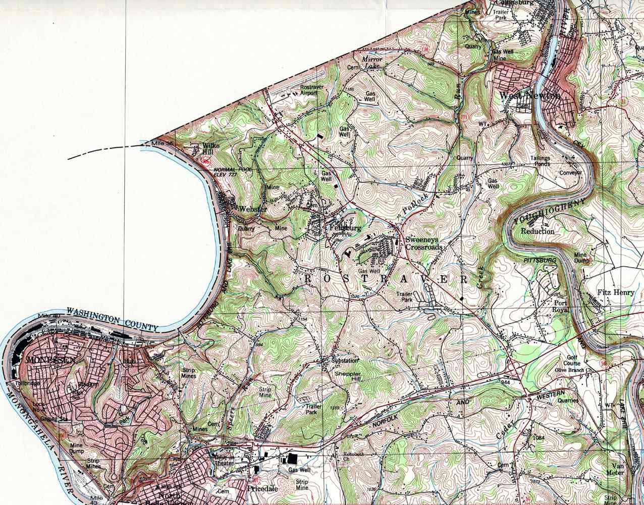
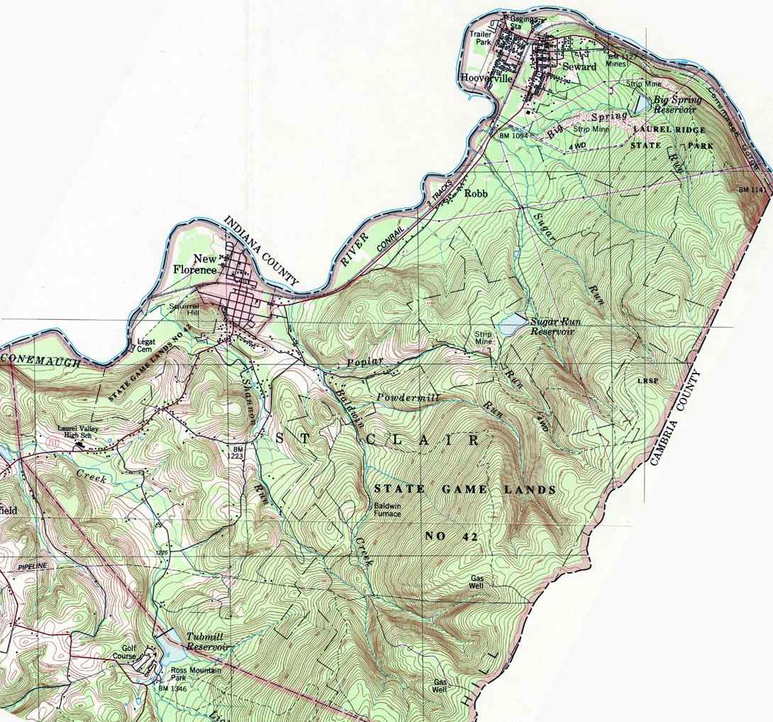
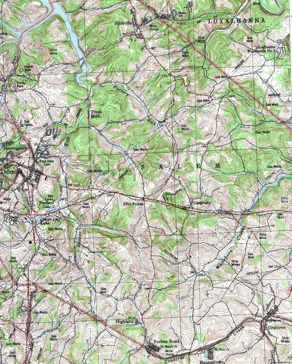
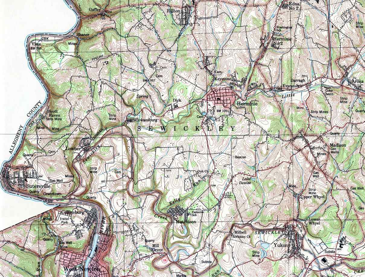
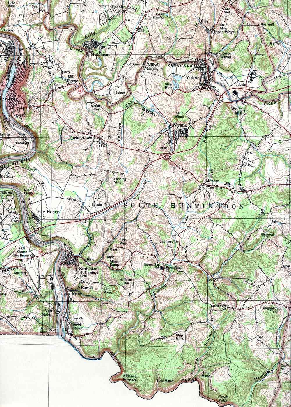
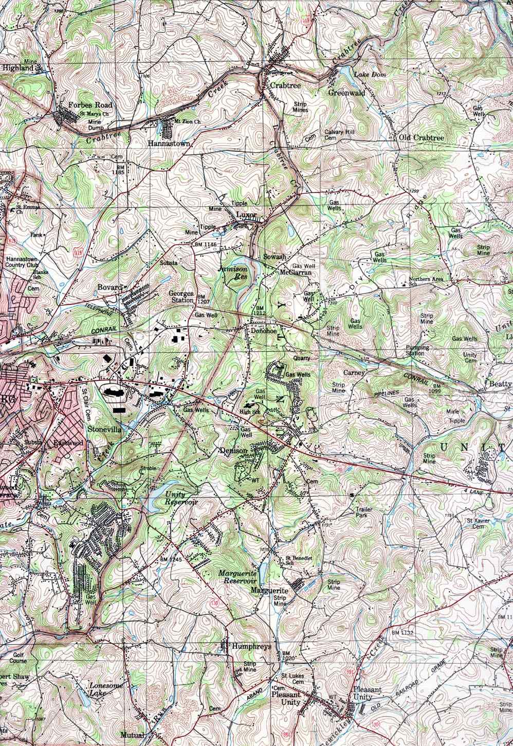
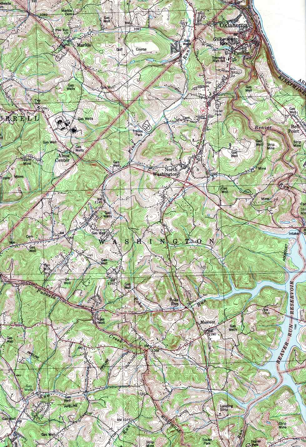
| Image Map: This is a clickable image map of townships and
boroughs in Westmoreland County Pennsylvania. A text list of the township
maps is shown below. The township images are cropped from a 1/50,000 USGS
Geological Survey Map of Westmoreland County dated 1987. The 1/24,000 maps
which are the basis of the county map are dated 1953 to 1967.
Adjacent counties: |
|
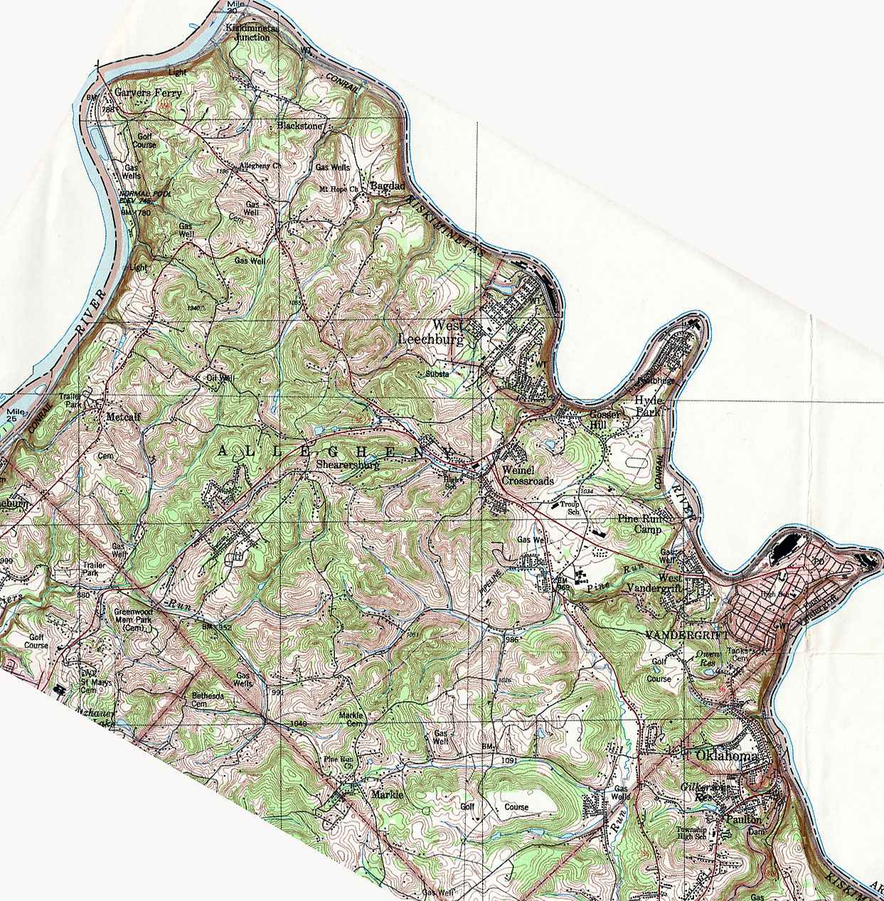
- Allegheny, Bagdad, Blackstone, East Vandergrift, Garvers Ferry, Gossier Hill, Kiskiminetas Junction, Hyde Park, Markle, Metcalf, Pine Run Camp, Shearersburg, Vandergrift, Weinel Crossroad, West Leechburg, West Vandergrift
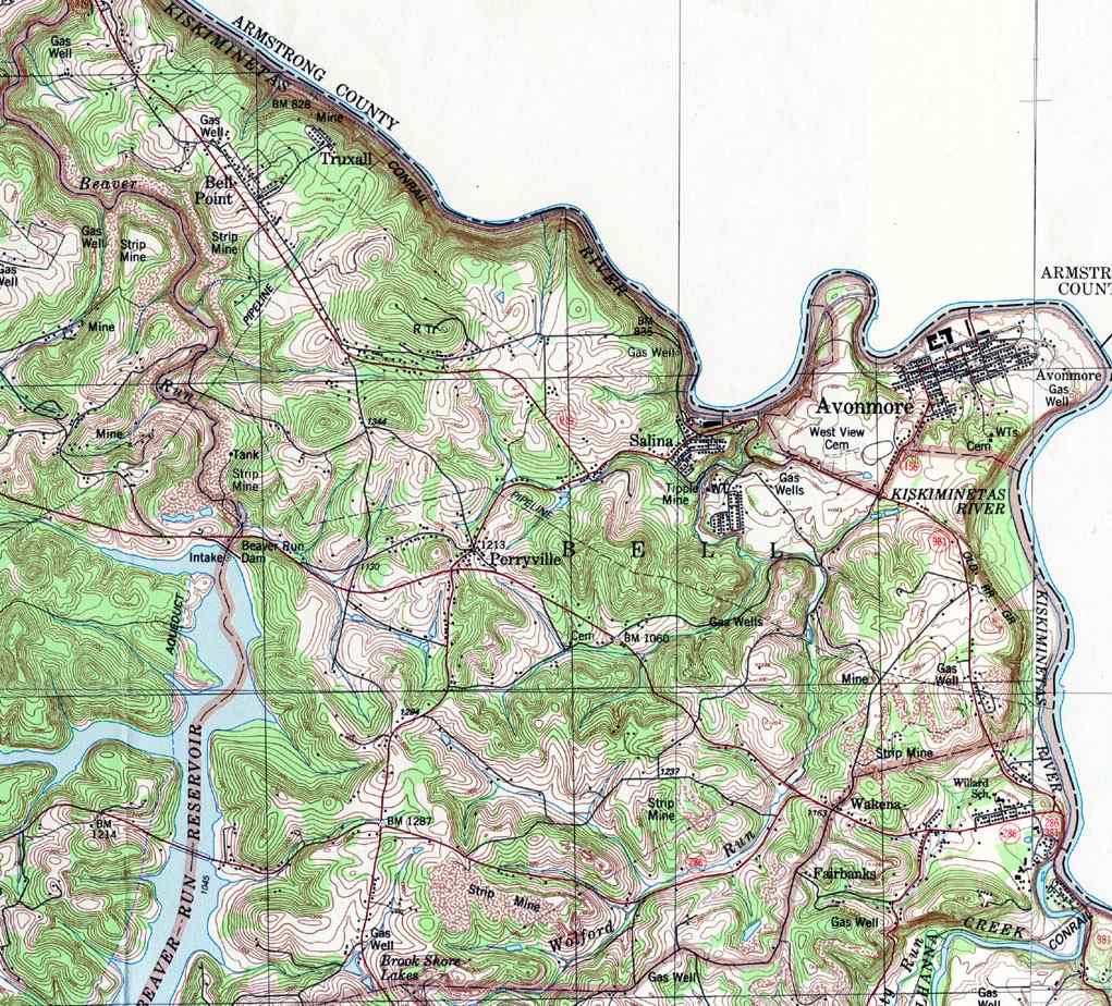
- Bell, Avonmore, Bell Point, Perryville, Truxall
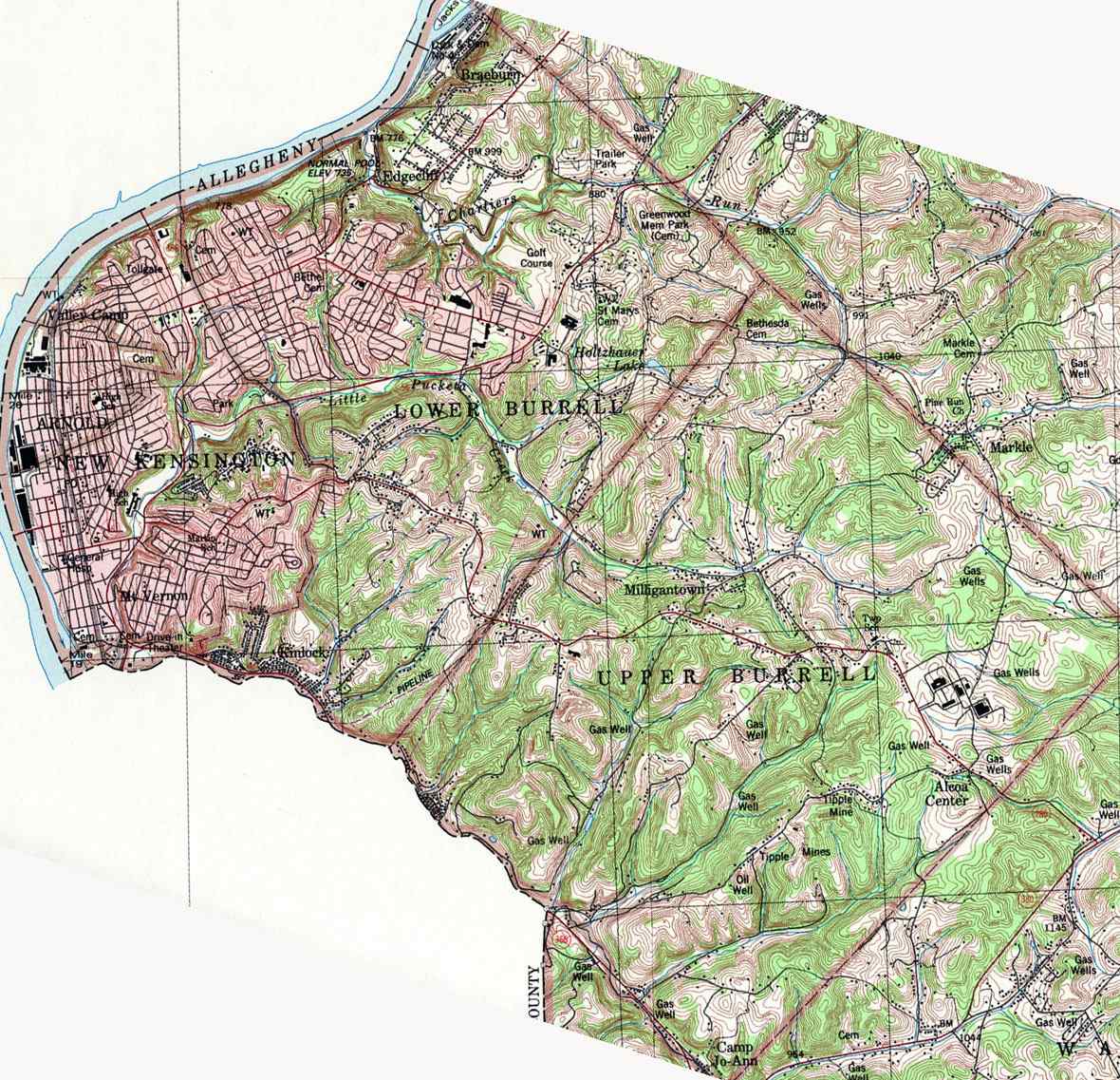
- Burrell, Upper and Lower, Arnold, Alcoa Center, Braeburn, Camp Jo-Ann, Edgecliff, Kimlock, Milligantown, Mt Vernon, New Kensington, Valley Camp
- Cook, Mannsville, Pleasant Grove, Stahlstown, Weaver Mill
- Derry (East), Atlantic, Bairdstown, Brenizer, Burds Crossing, Derry, Grays, Hillside, Millwood, New Derry, Peanut, Seger, Torrance, West Derry
- Derry (West), Bradenville, Cooperstown, Latrobe, Mechesneytown, New Alexandria, Snydertown, Superior
- Donegal, Camp Alliquippa, Champion, Cummingswood Park, Donegal, Hopewell, Horners Mill, Jones Mill, Kregar
- East Huntingdon, Alverton, Bethany, Buckeye, Central, Chaintown, Hawkeye, Iron Bridge, Mayfield, Miedel Hill, Morewood, Mt Nebo, North Scottdale, Pinetree, Ridge View, Rocktown, Ruffs Dale, Scottdale, Snydertown, Tarrs, Thornwood, West Lauffer, West Overton
- Fairfield, Bolivar, Camp Echo, Camp Fairfield, Camp Twin Echo, Camp Kauffman, Lockport, Rachelwood, Ross Mt Park, West Bolivar, West Fairfield,
- Greensburg
- Hempfield (east), Armbrust, Bovard, Carbon, Eastwood, Georges Station, Greensburg, Hannastown, Luxor, Maplewood Terrace, Midway, South Greensburg, Southwest Greensburg, Stonevilla, Whites Hill
- Hempfield (west), Adamsburg, Arona, Centerville, Darragh, Edna No. 1, Edna No. 2, Evenstown, Foxtown, Grapeville, Herminie No. 2, Hunken, Lincoln Hts, Madison, Middletown, Millersdale, New Stanton, Old Stanton, Paintersville, Radenbaugh, Stanton Hts, Youngwood
- Irwin
- Jeanette
- Latrobe
- Ligonier (east), Hillsview, Laughlintown, Laurel Mt Village, Laurel Mt Park, Oak Grove, Thomas Crossroads, Waterford, Wilpen
- Ligonier (west), Bells, Buttermilk Falls, Darlington, First Church Camp, Ligonier, Longbridge, Milbank, Rector
- Loyalhanna, Fairbanks, Loyalhanna Woodlands, Mannitto Haven, Moween, Wakena
- Mt Pleasant, Acme, Alice, Bridgeport, Brinkerton, Carpentertown, Kecksburg, Laurelville, Mammoth, Mellingertown, Mt Joy, Mt Pleasant, Norvelt, Orchard Hill, Ramsay Terrace, Southwest, Standard, Standard Shaft, Trauger, United, Weavers Old Stand, Weltytown
- Murrysville, Delmont, Dunningtown, Export, Newlonsburg, Ringertown, Sardis, West Export, White Valley
- New Kensington
- North Huntingdon, Ardara, Barnes Hill, Browntown, Cavettsville, Cereal, Circleville, Guffy, Hahntown, Irwin, Larimer, North Irwin, Penn Glyn, Robbins, Shawtown, Stewartsville, Sunset Valley, Trafford, Wendel, Westmoreland City
- Penn, Blackburn, Boquet, Claridge, Harrison City, Jeanette, Level Green, Manor, McCullough, Paintertown, Penn, Pleasant Valley
- Rostraver, Collinsburg, Fellsburg, Monessen, North Belle Vernon, Port Royal, Pricedale, Sweeneys Crossroads, Van Meter, Webster, West Newton, Wilko Hill
- St Clair, Hooverville, New Florence, Robb, Seward
- Salem, Congruity, Five Points, Forbes Road, Highland, Shieldsburg, Slickville, Trees Mills
- Sewickley, Herminie, Hutchison, Lower Whyel, Upper Whyel, Sutersville, Gratztown, Scot Haven, Lowber, Cowansburg, Shaner, Vista, Rillton, Dick, Deystone,
- South Huntingdon, Alliance Furnace, Centerville, Eureka, Fitz Henry, Jacobs Creek, Mendon, Milbell, Mill Grove, Reagantown, Reduction, Smithton, Turkeytown, Waltz Mill, West Newton, Wyano, Yukon
- Unity (East), Baggaley, Dorothy, Edgewater Terrace, Hostetter, Kingston, Latrobe Airport, Lawson Hts, Lloydsville, Manito, St Vincent Shaft, Solomon Temple, Whitney, Youngstown
- Unity (West), Beatty, Carney, Crabtree, Denison, Donohoe, Greenwald, Humphreys, Lycippas, Marguerite, McClarran, Mutual, Old Crabtree, Pleasant Unity, Robert Shaw Acres, Sowash
- Washington, Mamont, North Washington, Oklahoma, Paulton
![]()
Return to Westmoreland County Home Page