![]()
Transcription(s):
Not currently transcribed
Photograph(s)
Overview picture only
History
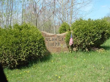
The Beulah Land Cemetery was started in 1876 and is still in active use.
GPS Coordinates
Latitude: 41.092433
Longitude: -78.874233Driving Directions
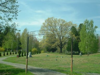
From Reynoldsville go east on Main Street (Rt 322) and turn left on Beech Street. Turn left on Grant Street at the Beulah Land marker rock (rock pictured to the right). You will pass through the Prescott/Baptist Cemetery - Beulah Land will be at the end of this road when you pass under the sign pictured above right.
Return to the Cemetery Page
![]()
Return to the Jefferson County Genealogy Project