
|
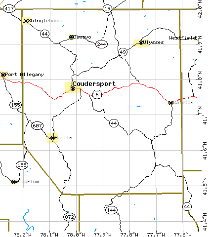
Map of Potter County, Pennsylvania Showing Surrounding Counties
Potter County is bounded by Tioga and Lycoming Counties on the east, Cameron and Clinton Counties on the south and Cameron and McKean on the west. The north is bounded by the New York State counties of Allegany and Steuben.
Maps derived from U. S. Bureau of the Census Tiger maps. The maps are public domain and, therefore, free of copyright problems.
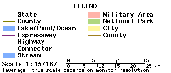
Potter County Showing Major Highways.
|
|
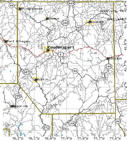
Potter County Showing Secondary Roads.
|
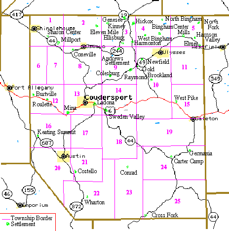
Potter County Showing Townships and Settlements.
 |
|
1 Sharon 2 Oswayo 3 Genesee 4 Bingham 5 Harrison 6 Pleasant Valley 7 Clara 8 Hebron |
9 Allegany 10 Ulysses 11 Hector 12 Roulette 13 Eulalia 14 Sweden 15 Pike 16 Keating |
17 Homer 18 Summit 19 West Branch 20 Portage 21 Sylvania 22 Wharton 23 East Fork 24 Abbott 25 Stewardson |
History of the development of Potter County's townships, including a discussion of why important to genealogists.
Map of Potter County, PA in 1895
Maps locating geographic features in Potter County from the U.S. Geological Survey - National Mapping Information System. Almost 1000 features listed for Potter County including hills, valleys, creeks, trails and towns! If you want to know where "Bailey Hill" is in Potter County, this is the place.
Census Maps and County Formation Maps for Pennsylvania Counties
![]()
Return to the Potter County Genealogy Project