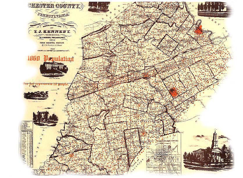
- 1860 Chester Population Map
- 1833 Map of East Fallowfield
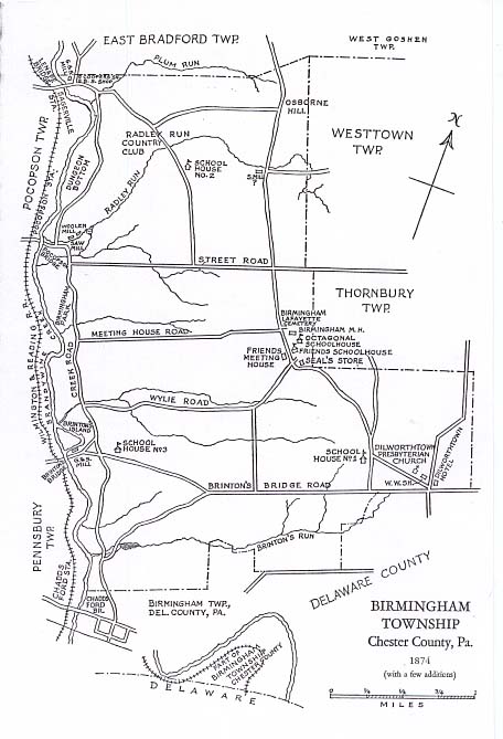
- 1874 Birmingham Township Map
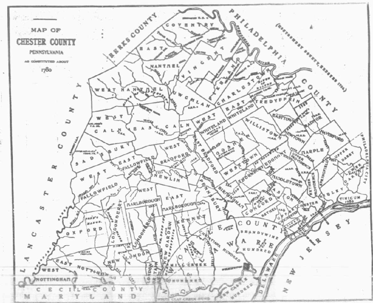
- 1780 Chester County Map
- 1683 Chester County Map
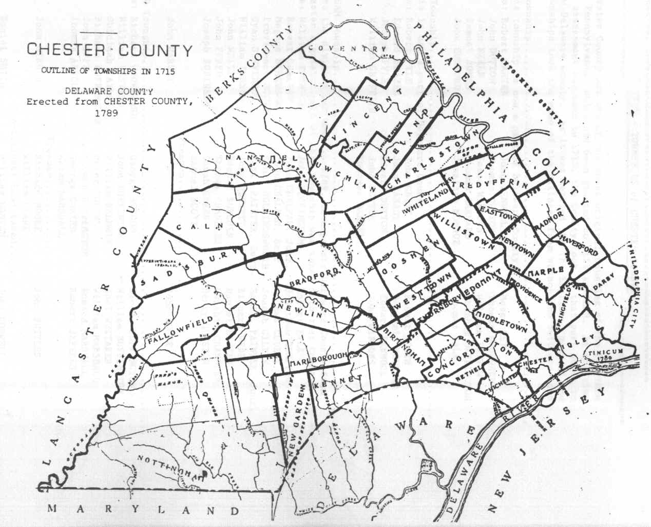
- 1715 Chester County Map
- Chester and Lancaster County Map with MMS
- Lionsville 1873 Map
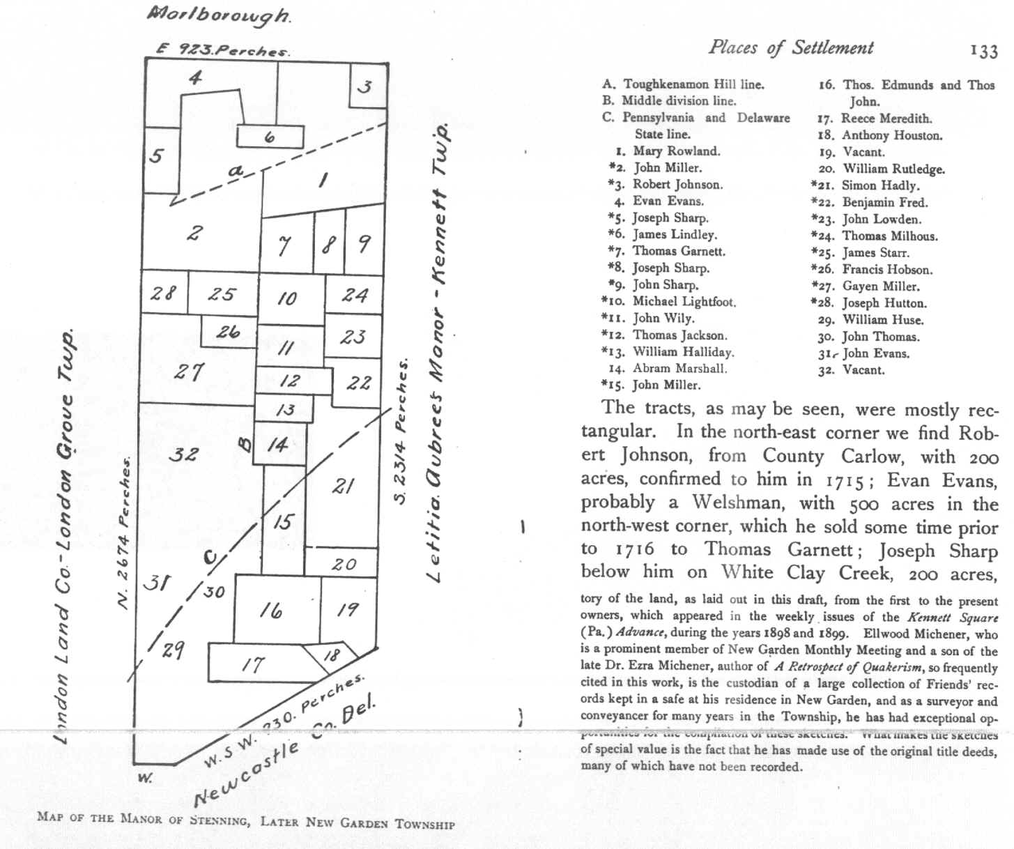
- Map of the Manor of Stenning, later called New Garden Township
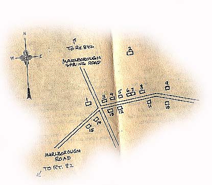
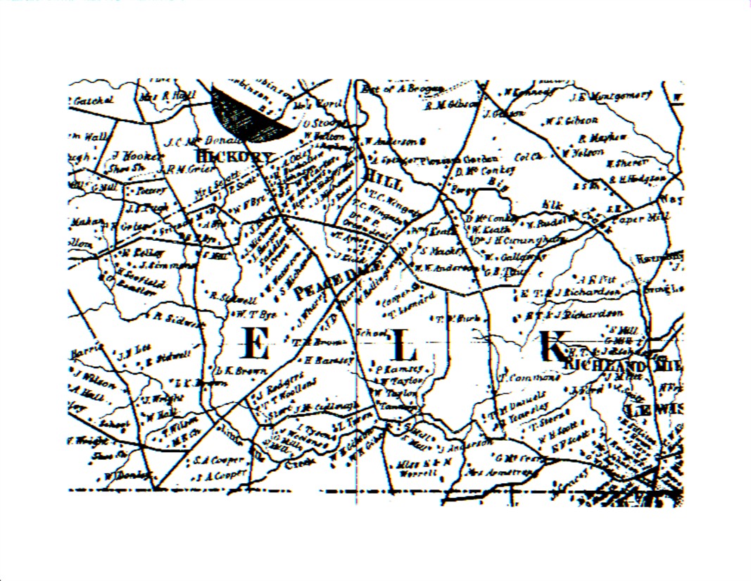
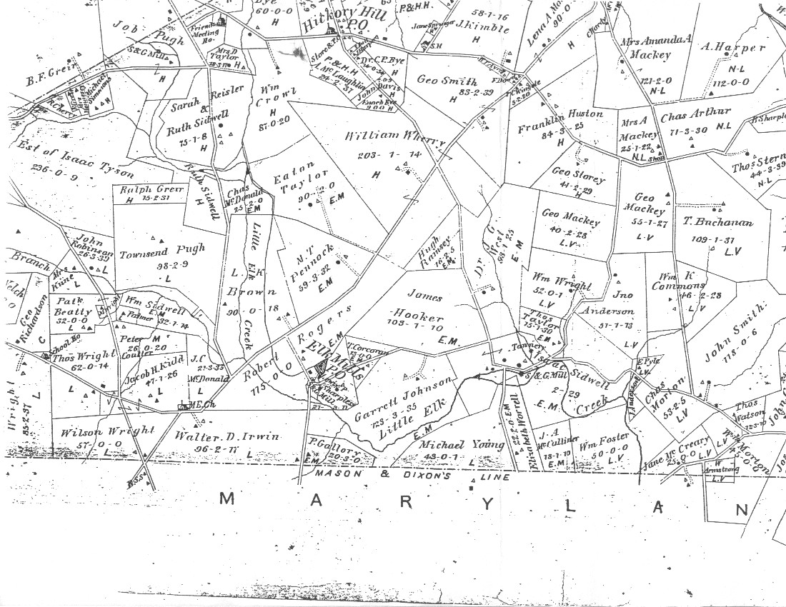
- Marlborough
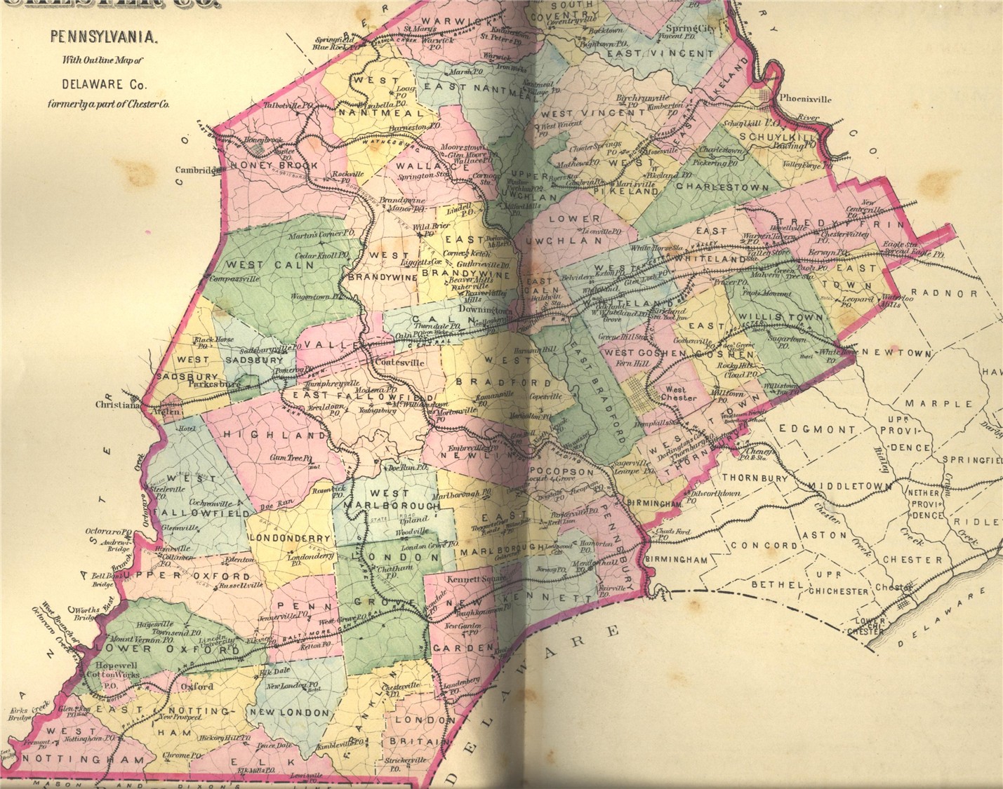
- Maps
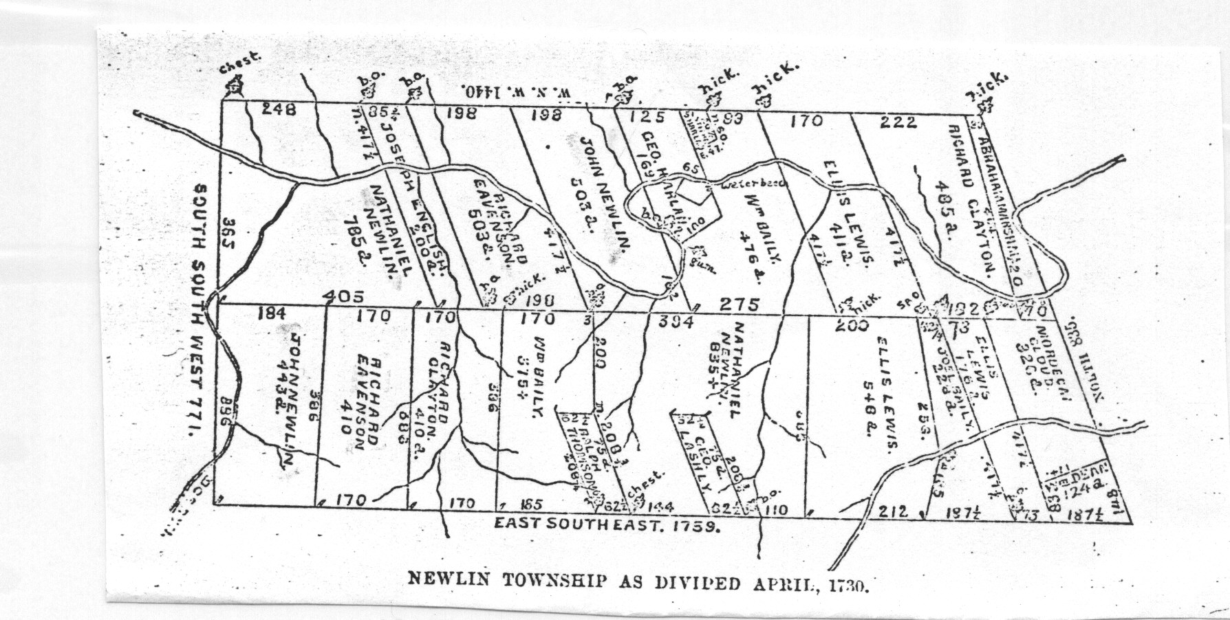
- Newlin Township Map - 1730
- 1883 East Fallowfield ... names of those North of the Strasburg Road
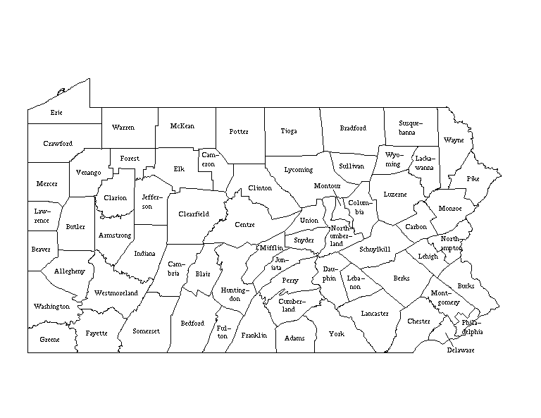
- Present day Pennsylvania and her Counties
- Names on an 1883 Uwchlan map
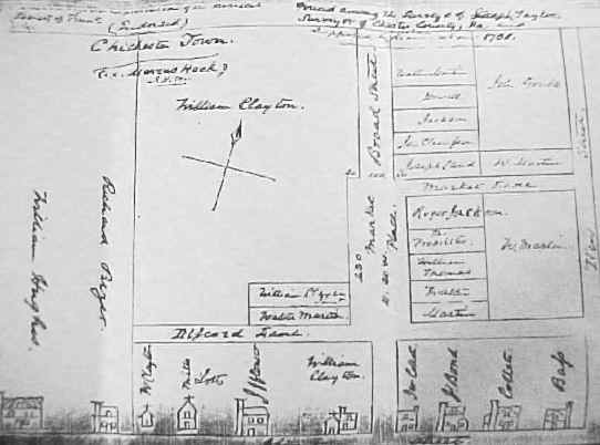
- Early Map of Chichester
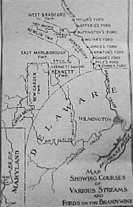
- The Brandywine and her fords
- 1780 Chester County Map with Townships
- Lancaster Co map with MMs
- Philadelphia Campaign Hessian Map (showing Chester County)
- 1912 Chester County Map
- Landowners listed on Kennet Maps ca 1730-1770
- Early Patents and Grants found on Edgmont Township Map
- London Britain and Franklin Townships
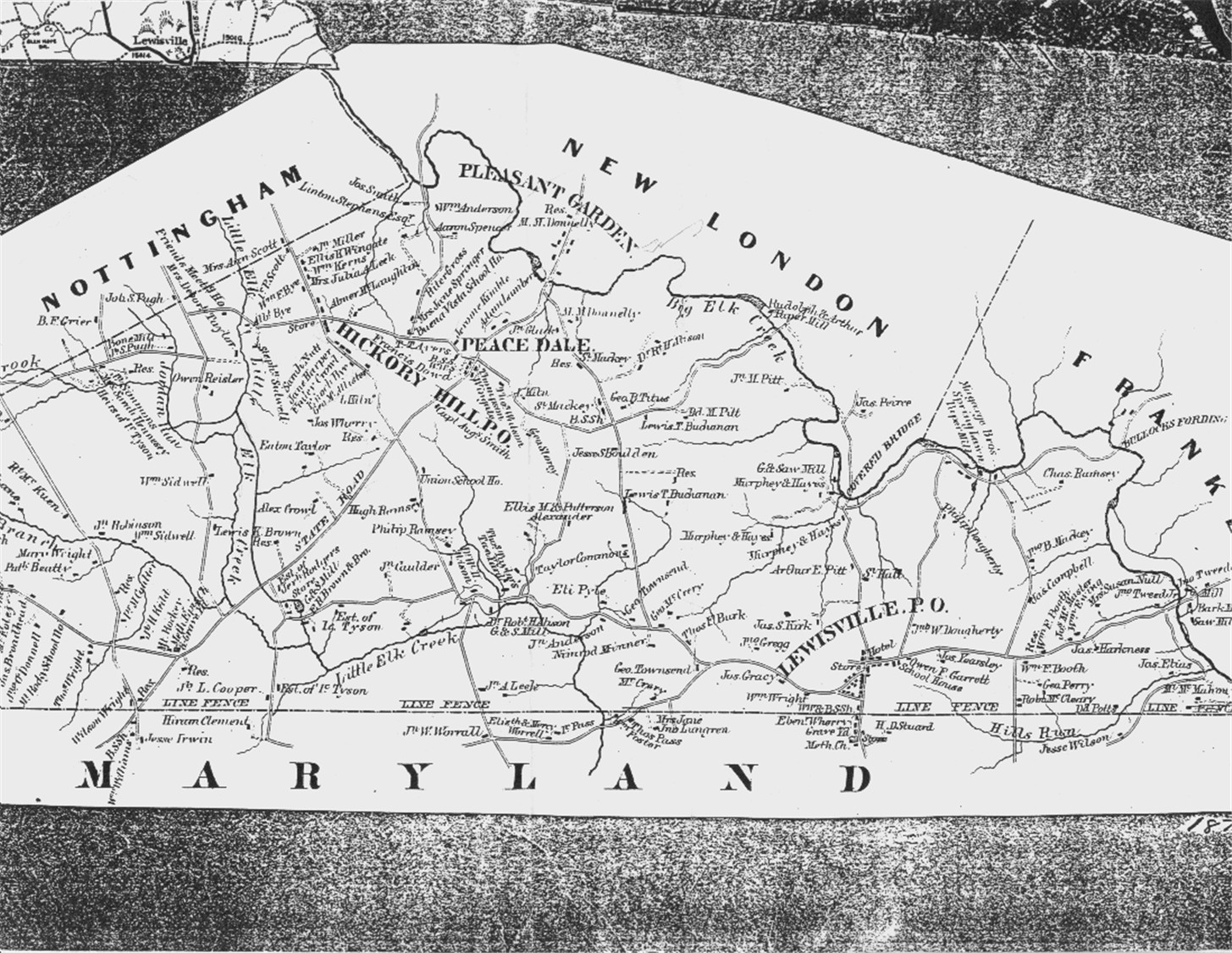
- Nottingham Maps
- http://www.usgwarchives.net/pa/chester/maps/enott1860.jpg
- http://www.usgwarchives.net/pa/chester/maps/enott1873.jpg
- http://www.usgwarchives.net/pa/chester/maps/enottfarms.jpg
- 1881 Chester
- Lionsville - Names Found on an 1873 Map
- PA Historical Maps
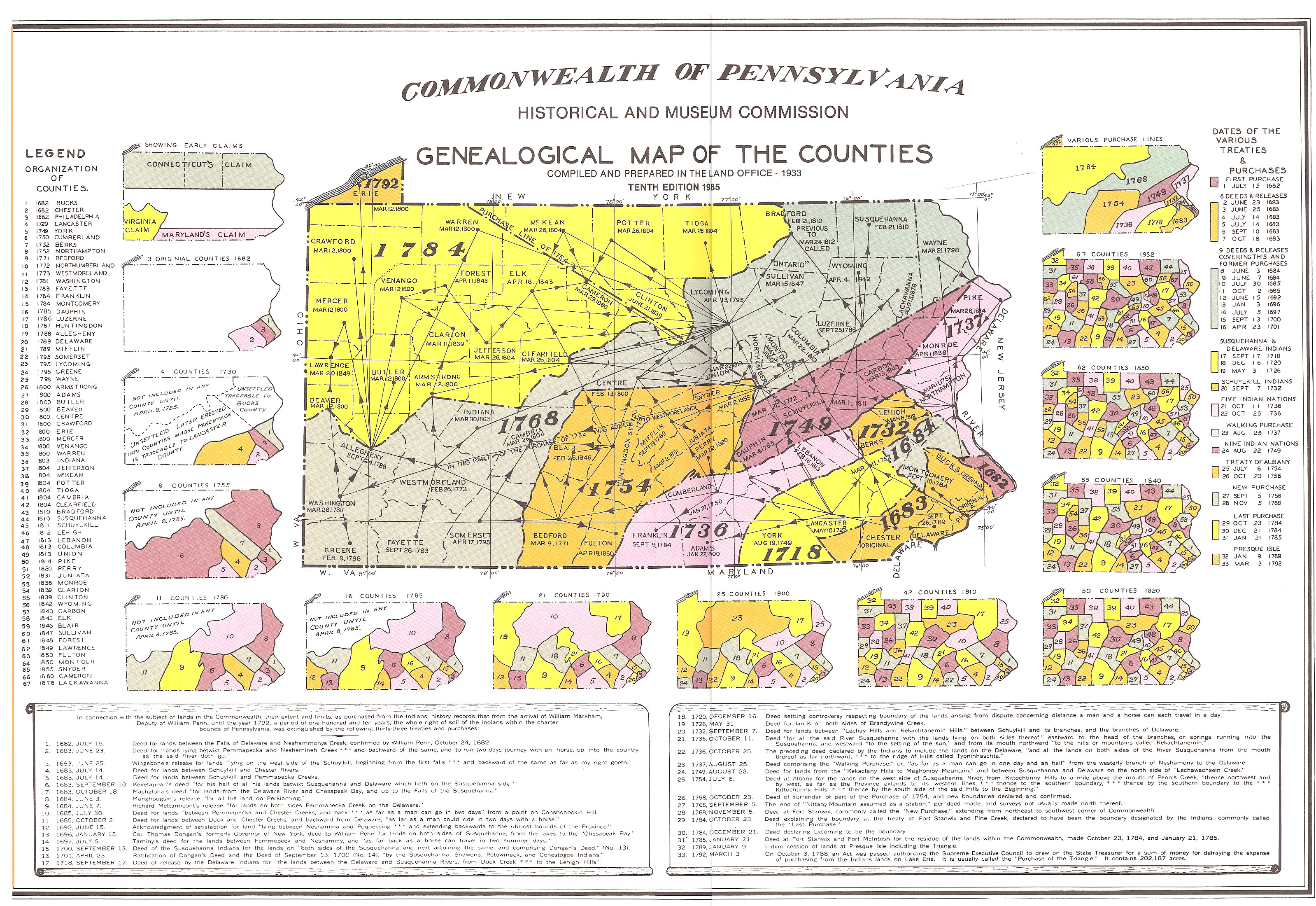
- Maps Showing County Formation
- Formation of Pennslvania Counties
- Atlas of Historical County Boundaries
- http://www.genealogyinc.com/pennsylvania/maps/pa_cf.htm
- http://www.genealogyinc.com/maryland/maps/md_cf.htm
- LOC Zoomable Map for Chester
- The ADC Map folks produce county maps divided up on pages of a book about 10X14...because only a small section of the map is on each page, they are able to be wonderfully complete, including churches, cemeteries, historic sites, Quaker meeting houses, POs, points of interest, museums, libraries, all roads and streams, etc.....everything a genealogist would want. You can call them 1-800-ADC-MAPS or they are on line www.adcmap.com I can't recommend these highly enough (the price is around $11.00)
- Bureau of Land Management - Federal Land Patents and Survey Maps
- Current Maps
- Aerial photography
- National Mapping Service - A WONDERFUL tool to find anything listed on a US map: town, mountain range, cemetery, etc.
- Another Great Map Site
- Ancestor Tracks - Using Maps to Track your Ancestors - some stuff to buy and lots of free stuff
![]()
Return to Chester County Home Page
(c) Chester County Pennsylvania Genealogy
Project